
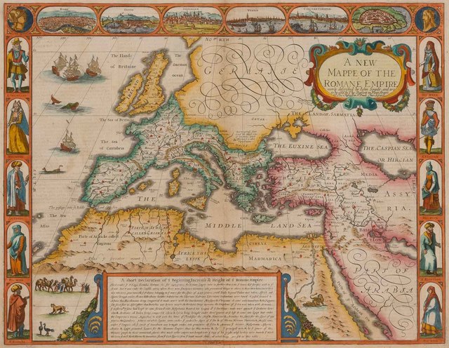
A Prospect of the Most Famous Parts of the World: Viz. Asia, Affrica, Europe, America, with...Grecia, Roman Empire, Germanie, Bohemia, France, Belgia, Spaine, Italie, Hungarie, Denmarke, Poland, Persia...Together with...Great Brittaines empire
Bequest of W. Gedney Beatty, 1941
Catalogue
- Year
- 1631
- Dimensions
- 16 15/16 x 12 5/8 x 1 3/16 in. (43 x 32 x 3 cm)
- Collection
- The Metropolitan Museum of Art
- Artist
- John Speed
Artist
John Speed was an English cartographer, chronologer and historian of Cheshire origins. The son of a citizen and Merchant Taylor in London, he rose from his family occupation to accept the task of drawing together and revising the histories, topographies and maps of the Kingdoms of Great Britain as an exposition of the union of their monarchies in the person of King James I and VI. He accomplished this with remarkable success, with the support and assistance of the leading antiquarian scholars of his generation. He drew upon and improved the shire maps of Christopher Saxton, John Norden and others, being the first to incorporate the hundred-boundaries into them, and he was the surveyor and originator of many of the town or city plans inset within them. His work helped to define early modern concepts of British national identity. His Biblical genealogies were also formally associated with the first edition of the King James Bible. He is among the most famous of English mapmakers.
Full artist profile →Record
Verified by WattsOS- Artist
- John Speed
- Year
- 1631
- Dimensions
- 16 15/16 x 12 5/8 x 1 3/16 in. (43 x 32 x 3 cm)
- Watts ID
- WW-1631-329984
Source
- Collection
- The Metropolitan Museum of Art
- Source
- met
- Reference
- View at source
- Status
- verified